
A village on the Senio
that is losing its people
Casola Valsenio is a small town in the hills behind Faenza, in the Senio valley: a compact historic centre gathered around its square, woods and vineyards a short walk away, and no industrial estate on its edges.
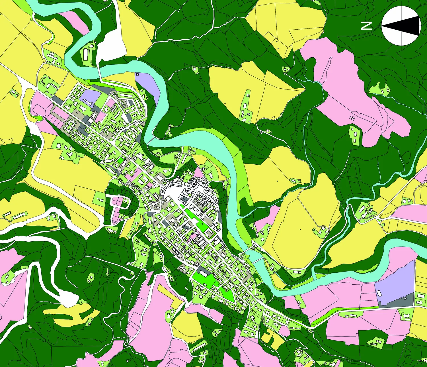
And yet the village is emptying: from 5,757 inhabitants in 1951 to 2,842 in 2001, against the trend of the neighbouring municipalities. The thesis starts from the study of the territory, first natural and then built, and arrives at the design of a place that Casola lacks: a civic centre for community life, in a neighbourhood cut off from the historic centre by a bend in the river.
“Why, despite the quality of the town centre, are we losing our future?”
I asked this in the introduction to my thesis, together with another question: how to turn the village from a place people leave into a place people come to. To answer it I started by getting to know the place: first the territory, then the town, and finally the project.
First the natural,
then the built
The analysis starts from what is the result of time rather than of people: landforms, geology, vegetation. Five maps of the whole municipal territory, all with the same framing.
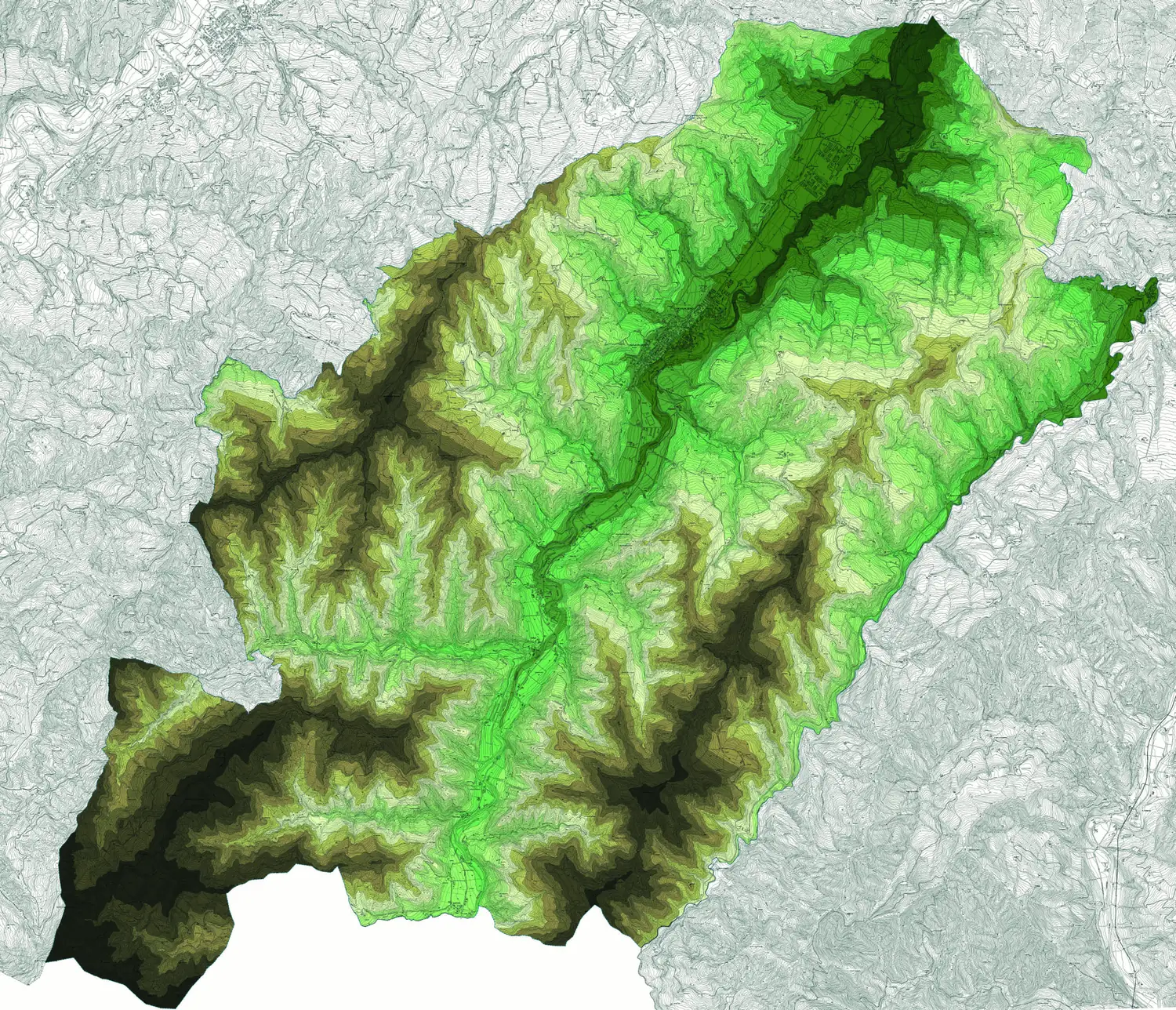
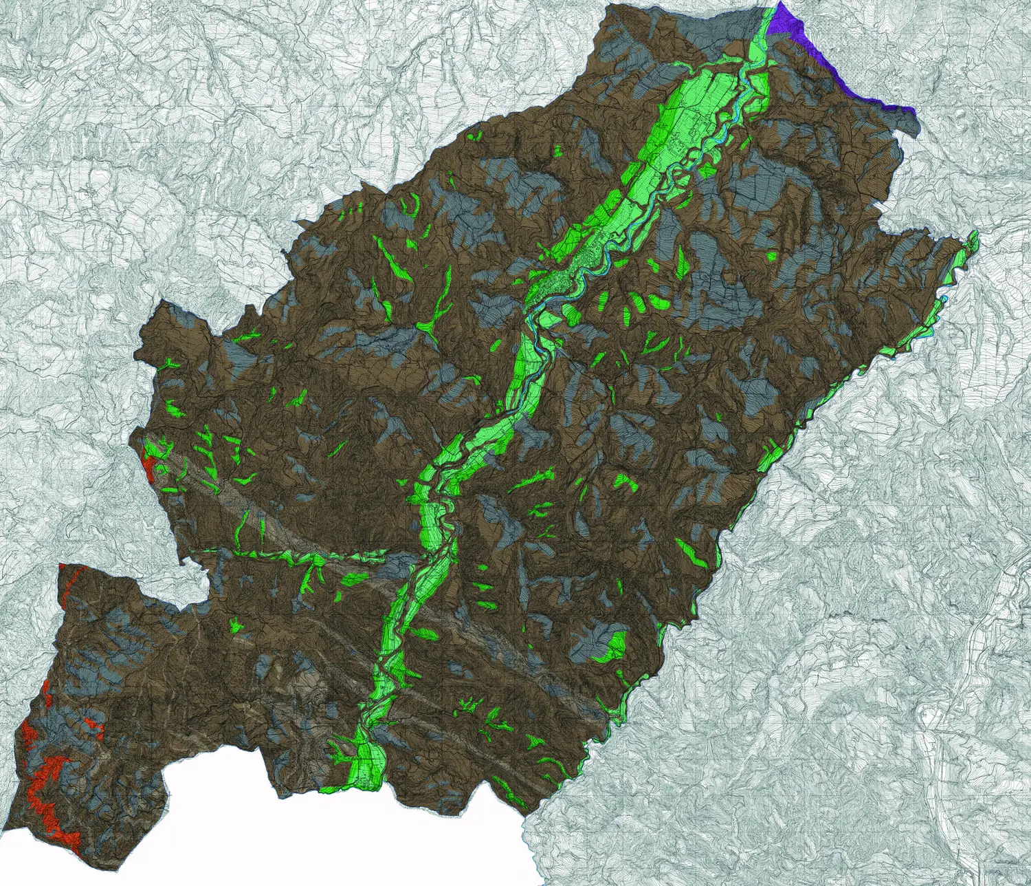
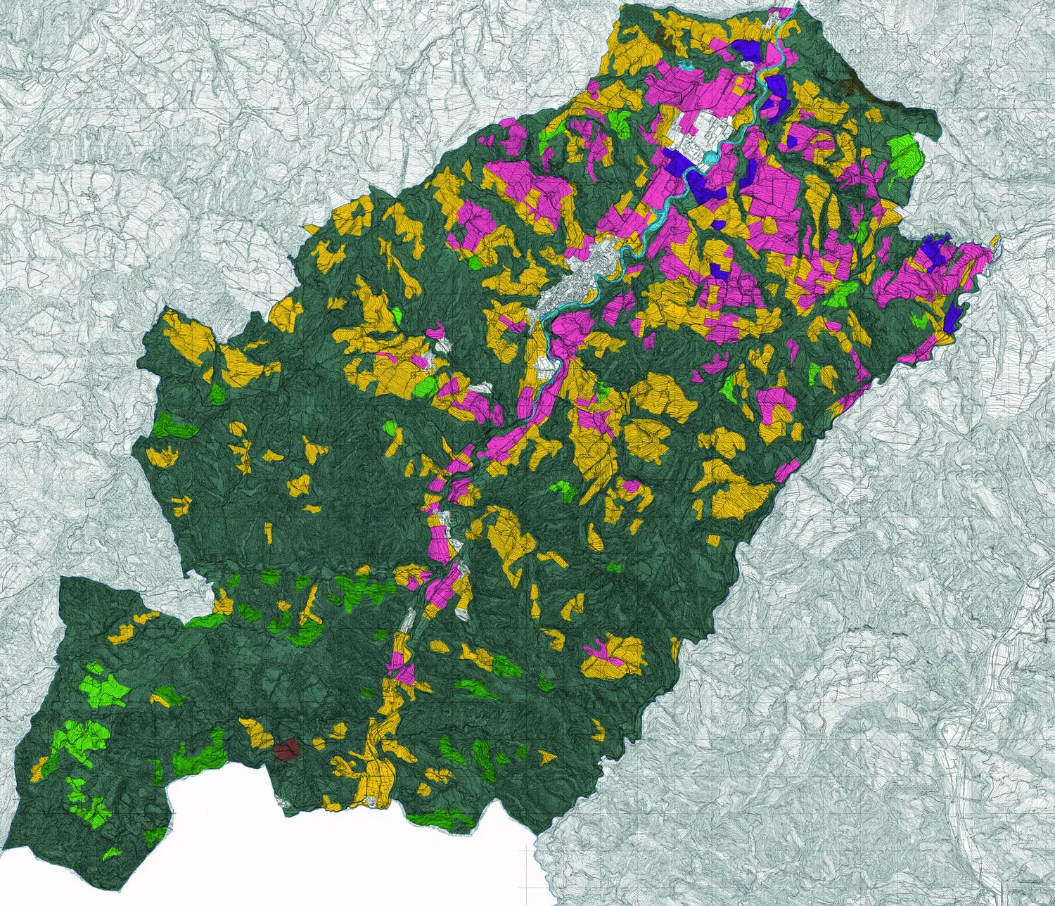
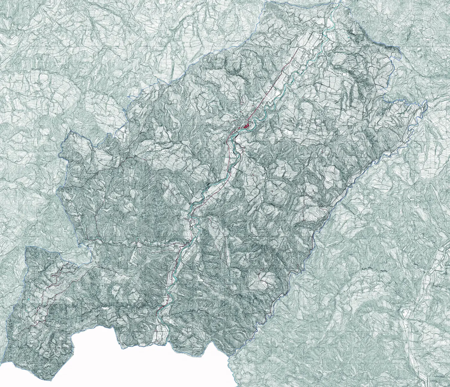
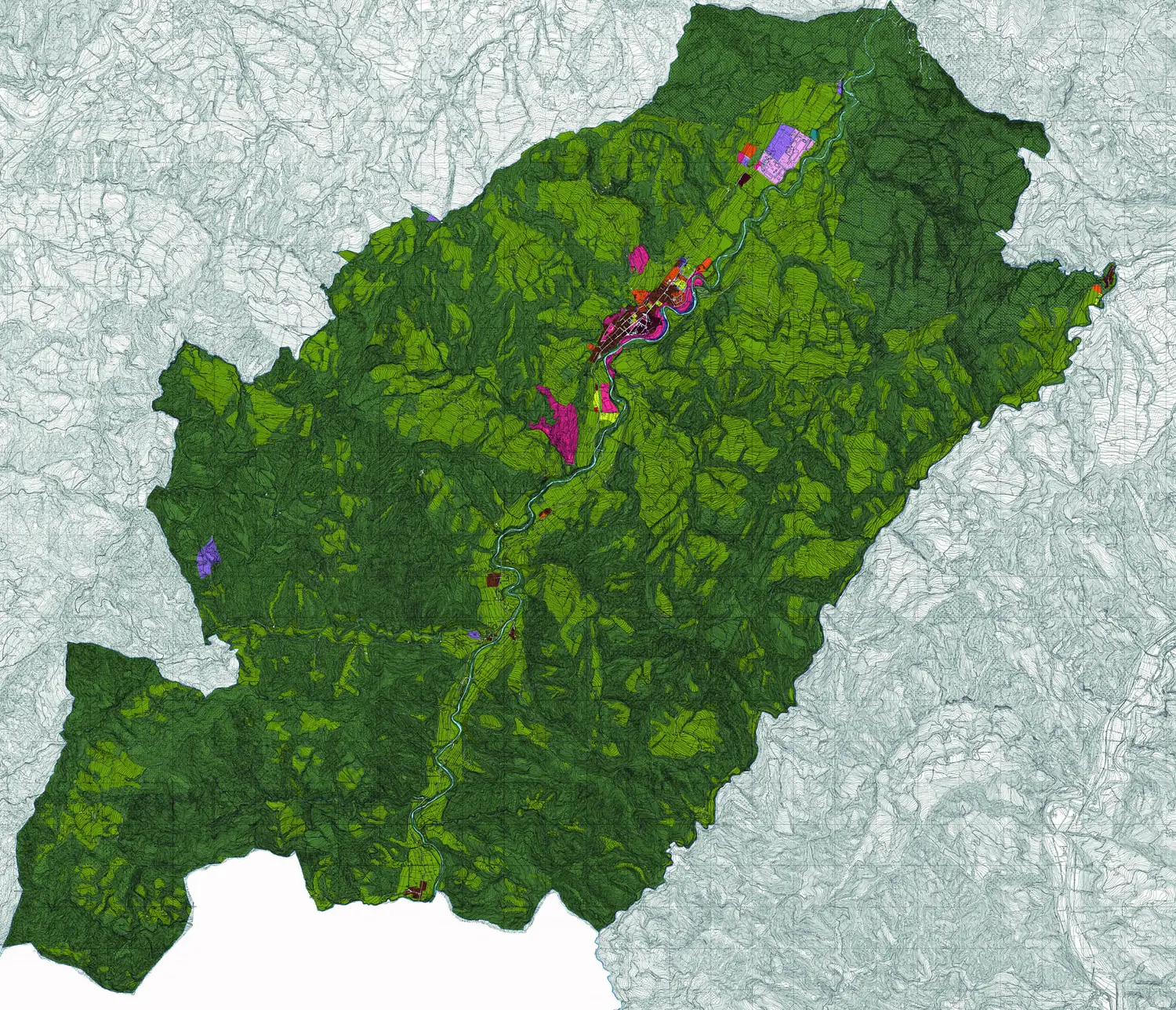
Landforms
The municipality stretches between hills and mountains, from 100 to 800 metres. The Senio valley crosses it from south-west to north-east: it is there, on the alluvial terraces along the river, that the settlements lie.
100 m400 m800 m
Geomorphology
More than 80% of the territory is the Marnoso-arenacea Formation, the most typical unit of the Apennine chain. To the north, on the border with Brisighella, the Vena del Gesso (gypsum ridge) crops out; along the river, the alluvial deposits.
- Quaternary formation
- Active alluvial deposit
- Inactive alluvial deposit
- Eluvial-colluvial deposits and alluvial fans
- Landslide deposit
- Umbria-Marche-Romagna succession
- Visignano chaotic unit
- Pelitic-arenaceous lithofacies
- Marly-arenaceous flysch
- Vena del Gesso
- Gessoso-solfifera Formation
Agricultural and forestry uses
Woods and chestnut groves cover most of the territory. The valley floor is taken up by intensive farming, orchards and arable land; on the first hills, thanks to favourable microclimates, vineyards take hold.
- Bare arable land
- Orchard
- Vineyard
- Woodland
- Pasture
- Chestnut grove
- Rivers and other water bodies
- Exposed rock and badlands
- Timber plantations
The historic built footprint
The buildings and roads already present in 1853. At that time the valley floor was farmed as “piantata”: rows of vines trained on trees, alternating with arable fields. Today this landscape no longer exists.
- Buildings and roads present in 1853 (source: Gregorian Cadastre sheets)
The state of planning
The joint Municipal Structural Plan of the Faenza district, in force since 2010: the historic town and the urban zones along the valley floor, the rest of the territory protected for its landscape and natural value.
- Historic town and smaller historic centres
- Consolidated urban zones
- Zones for new residential development
- Zones for production activities
- Industrial expansion areas
- Public facilities and shared spaces
- Areas for utilities
- Areas for car parks
- Public parks and play areas
- Private green areas
- Agricultural areas of landscape value
- Areas of natural and environmental value
- Rivers and other water bodies
The village, building
by building
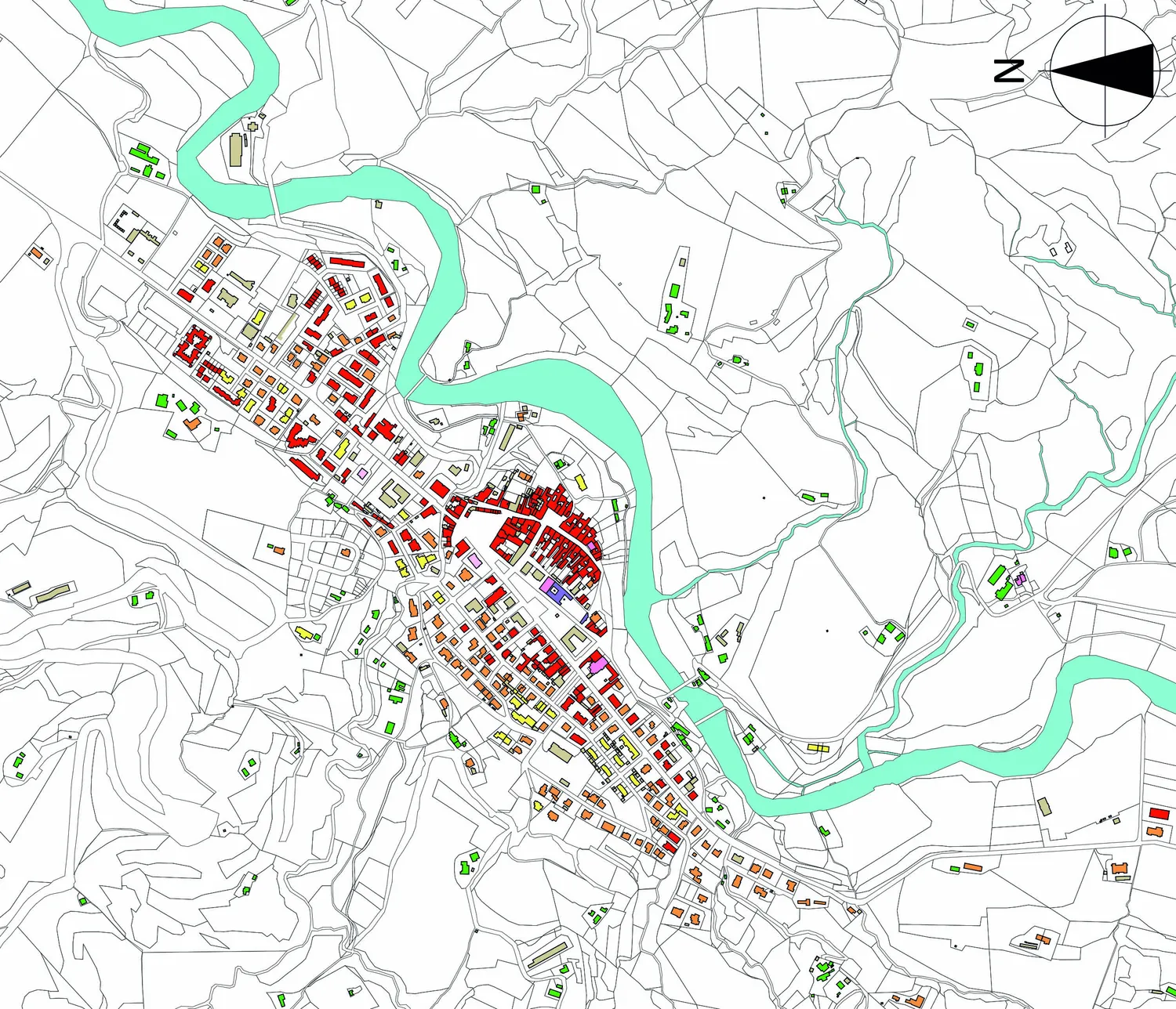
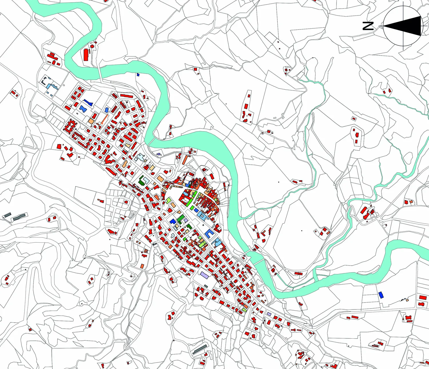
Then the scale narrows to the town itself: when each building was built, what type it is, what is on its ground floor, how the open spaces are used. From this the project area emerges: a neighbourhood beyond the bend in the river, with no central place.
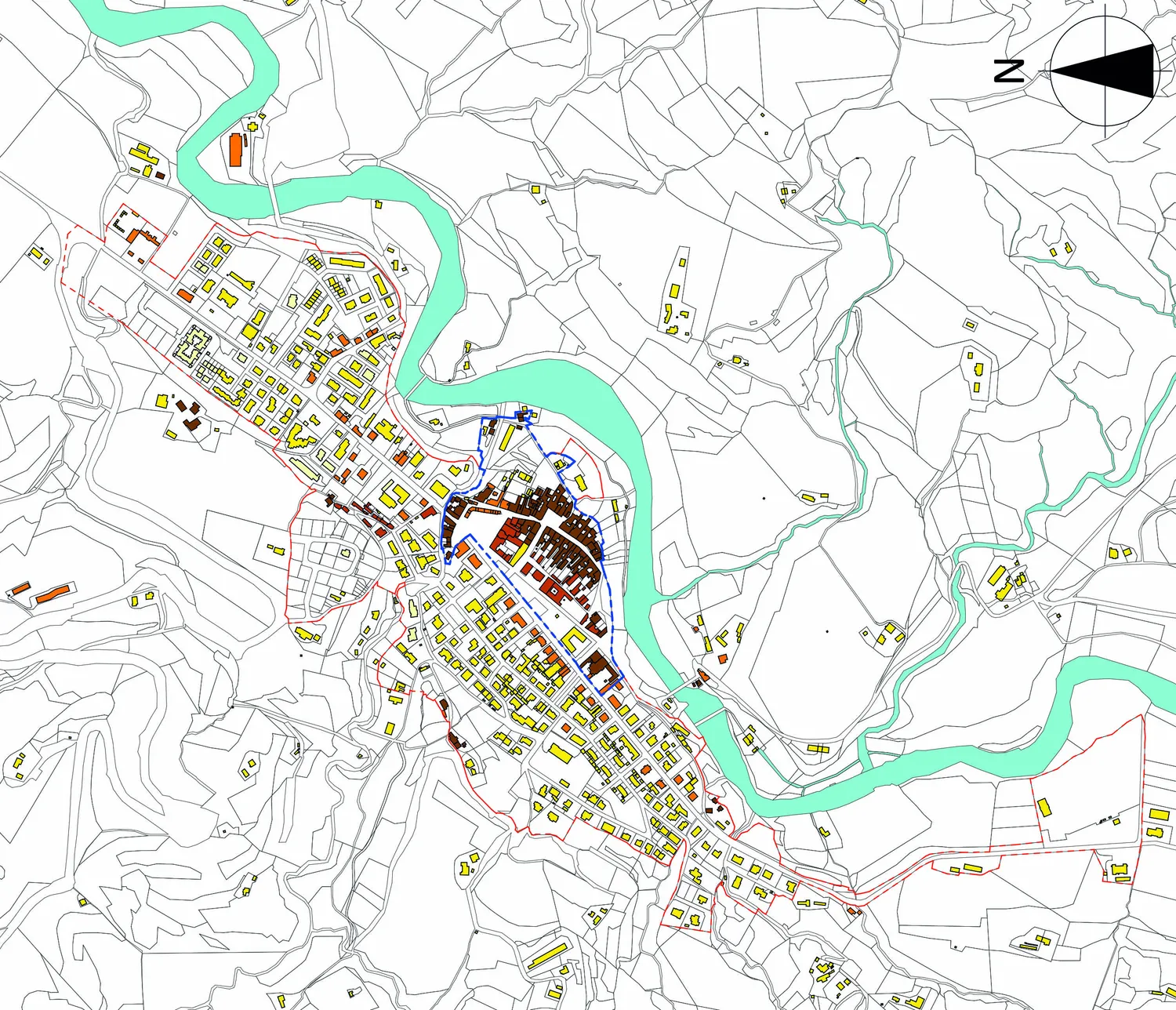
Urban growth
The core already shown in the 1835 Gregorian Cadastre is packed onto the terrace above the river. After the war the village grows downstream, towards its entrance: upstream the hills and the river are too close together, and there is no room on the right bank of the Senio.
- Built-up area boundary
- Boundary of the consolidated historic centre
- Buildings already in the Gregorian Cadastre (1835)
- Built between 1835 and the first IGM survey (1894)
- Built between 1894 and the second IGM survey (1934)
- Built between 1934 and the Regional Technical Map (2006)
- Built after 2006 (current cadastre)
Building types
Every building in the centre classified by type: the terraced row houses of the historic core, the villas and terraced houses of the expansion, the specialised civic and religious buildings.
- Row house
- Detached villa or small villa
- Terraced house
- Farmhouse and outbuildings
- Specialised civic building
- Noble palazzo
- Place of worship
- Specialised religious building
Ground floor uses
What is on the ground floor of each building: homes, shops, services. This is the map that shows where the public life of the village happens, and where it is missing.
- Residential
- Garage, storage, unused space
- Shop
- Craft workshop
- Bar or restaurant
- Banks, agencies, offices
- Town hall, courts and other public offices
- Cinemas, theatres, auditoriums
- Hospitals, care homes, health and social care facilities
- Places of worship, convents, cemeteries
- Schools, universities, research institutes, canteens
- Museums, exhibition spaces, libraries
- Gyms, sports facilities, sports clubs
- Barracks and police stations
- Railway stations, utility plants
- Other
Undeveloped land
Open space read by use: green and paved grounds of buildings, the farmland and woodland that reach into the village, public green space, car parks, playing fields.
- Green grounds of buildings
- Paved and asphalted grounds of buildings
- Farmland
- Woodland
- Public green space not open to the public
- Urban park
- Green square and roadside planting
- Car park
- Playing fields and sports grounds
- Uncultivated, unused or grassed land
A new civic centre,
in four steps
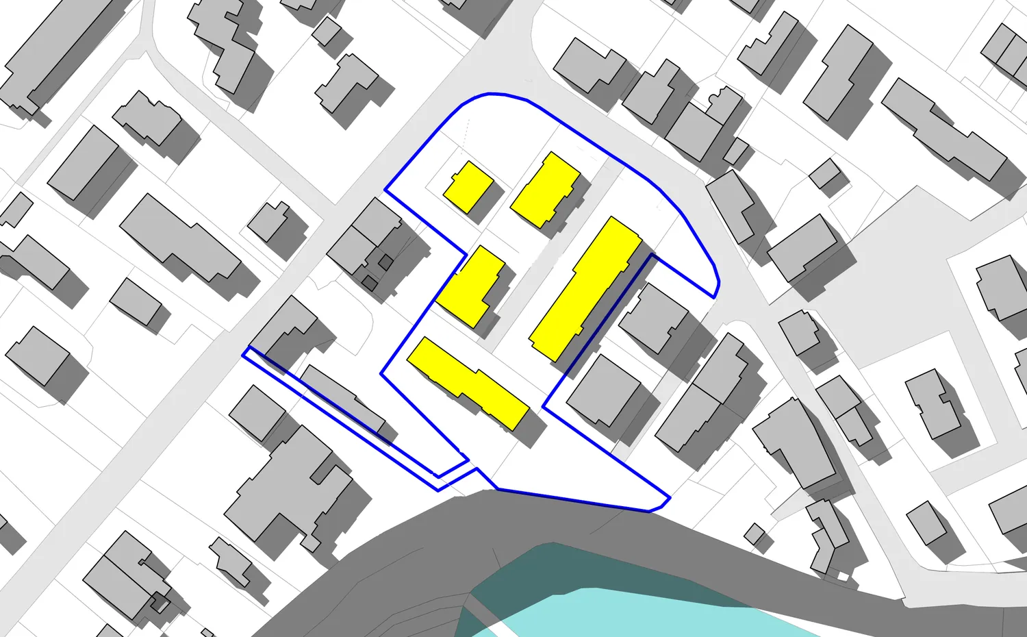
The site
At the junction of two roads, one of which links Casola to the towns around Faenza, five buildings of modest architectural quality: a plot area of 6,976 m². The project demolishes them and rehouses the residents in new two-storey terraced houses on a nearby site.
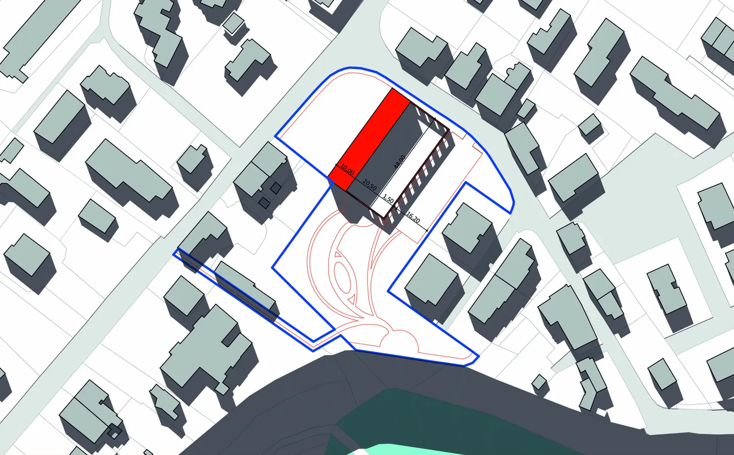
The new volume
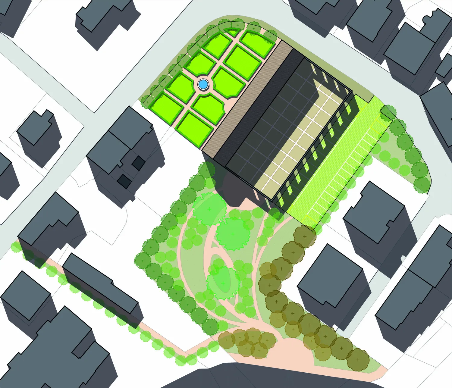
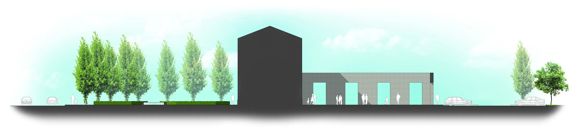
In place of the demolished buildings, a single public building 48 by 20 metres, with a pitched roof and a 12-metre ridge. It acts as a screen between two squares of a different nature: one planted, one paved.
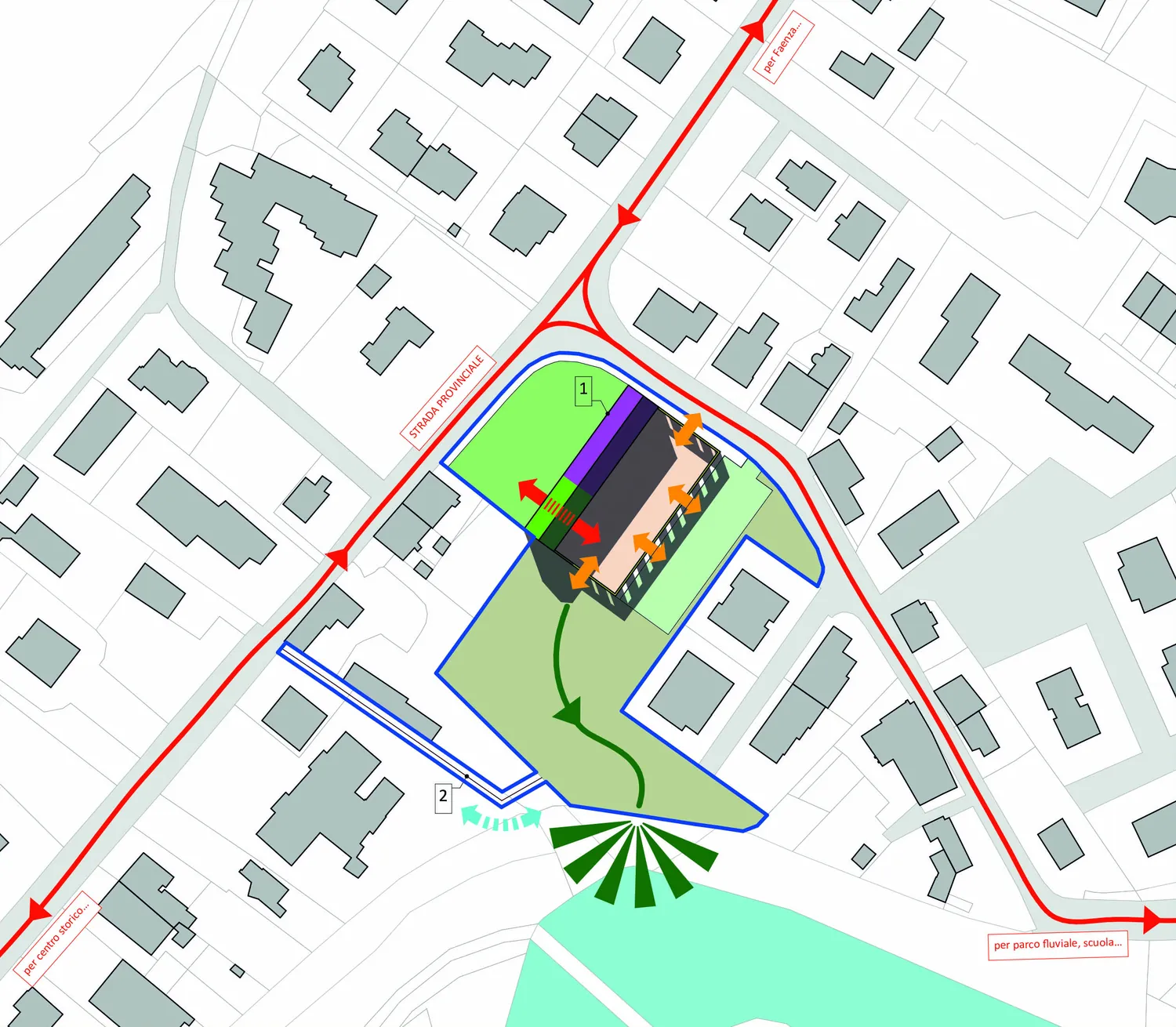
Uses and routes
The auditorium, as tall as the building, faces the street; the two-storey part holds the civic functions and the pedestrian passage. From the square a path leads down to the viewpoint over the river.
The site plan
The Italian garden on the provincial road, the paved square enclosed by walls, the car park and the large English landscape garden that slopes down to the bend of the Senio.
Paved, planted,
built
The public building
A brick building with load-bearing walls, timber floors and a clay tile roof carried by timber trusses. Inside, an auditorium as tall as the building and, on two levels, the rooms for civic functions. Outside, a pinkish render made from crushed brick.
The paved square
In front of the building, a square enclosed by pale walls, opened by rectangular gateways with lintels: an enclosure for markets, concerts and summer shows. Underfoot, local stone with travertine panels.
The Italian garden
Between the building and the provincial road, flower beds laid out on the same axes as the building and edged with box hedges. Two roundels: one in front of the entrance, the other around a reflecting pool. Along the pavement, an avenue of lime trees.
The English garden
The rest of the site becomes a park of maples and oaks, with native shrubs along a compacted earth path of varying width that starts from the square and the car park.
The viewpoint over the Senio
The path ends at a terrace cut into the bend of the river, protected by a steel balustrade. A three-metre-wide tree-lined footpath links it to the provincial road.


Civic magnificence,
at the scale of a village
The aim is the urban quality that the Renaissance called civic magnificence, which Giancarlo Consonni revisits in Urbanità e bellezza. The project takes up materials and techniques found on site, and looks to four references.
- Place des VosgesParis
A square, tree-lined plaza enclosed by uniform facades and crossed by pedestrian axes.
- Luxembourg PalaceParis
The garden that combines pools, Italian-style sections and a large English garden.
- Villa GiuliaRome
Three courtyards, two planted and one paved, enclosed by walls that act as backdrops.
- Malatestiana LibraryCesena
A historic building that combines architectural value and social purpose, facing a square.
The sheets
A.1
A mark that stays
Placing your own project in a territory leaves a permanent mark, which will inevitably change the lives of the people who live there.
That is why the work started from the place: repeated site visits, the territory observed from as many points of view as possible, from geology to the uses of the ground floors. The project follows from this: a civic place made of materials and forms already found in Casola, designed for the well-being of the people who live there, what the thesis calls public happiness.
Alma Mater Studiorum, University of Bologna
Ravenna Campus
School of Engineering and Architecture
Department of Engineering
Degree programme in Building Engineering
Thesis in Urban Planning
Casola Valsenio.
Dall’analisi territoriale al progetto di riconfigurazione urbana(Casola Valsenio: from territorial analysis to a plan for urban reconfiguration)
Candidate
Lorenzo Fava
Supervisor
Prof. Ilaria Agostini
Co-supervisor
Prof. Daniele Vannetiello
Academic year
2018/2019
Sheet title
Complete set, 17 sheets
Territory, town centre, project